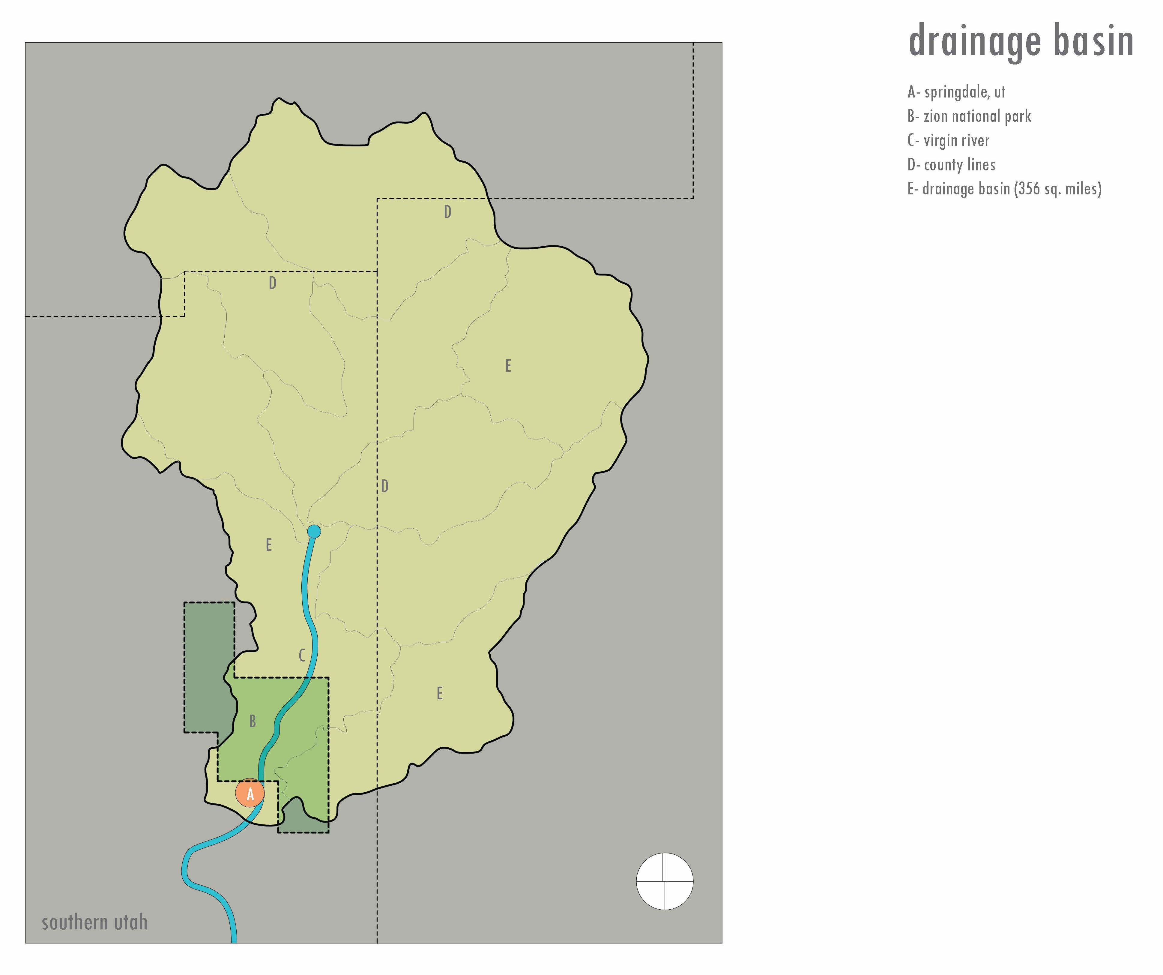
House in Springdale cont. The Virgin River is a small tributary that eventually flows into the Colorado River. The Virgin has a north and south fork, each with different ecosystems and drainage basins. The north fork begins in the mountains of Utah at Cascade Falls — a natural spring that gushes from a cave at a surprising 9,000 feet of elevation. It is this waterway that runs by the location of a project I recently designed in Springdale, Utah. Before passing the project site, the north fork’s drainage basin collects snow melt and rainwater from approximately 356 square miles of land area. Along the site’s southern edge, the North Fork of the Virgin River is relatively straight, extending approximately 2,000 lineal feet up stream. The low flow channel of the river, adjacent to the property, consists of a wide cobble bed with occasional large boulders. The active floodplain extends several feet from this edge up a steep slope toward the project area. The active floodplain between the low flow channel and the bank consists of sand, gravel and cobbles and is sparsely vegetated with mule fat, mature cottonwoods, and other herbaceous vegetation. Along the left overbank, the low flow channel extends to the edge of a lower sloped bank that is moderately vegetated with mature cottonwoods and mule fat. The high terrace along the left overbank is vegetated with juniper, rabbitbrush and sagebrush.
Although there is no evidence of the channel shifting in recent history, there appears to be a chance that a dramatic landslide event on the south bank could potentially push the river’s course closer to the project. The City of Springdale has mapped out a multi-level erosion hazard zone (EHZ), which is prone to natural channel movement or avulsion. Although this designation is not considered a “no build” zone, it serves as a notice to landowners of the inherent risks that should be addressed through design, insurance and appropriate land use. The 100-year flood plan sits at elevation 3,880 feet. The High Erosion Hazard Line is at elevation 3,883 feet, and the elevation at the building structure starts at 3,885 feet. Although the structure sits outside these two zones it does sit within the municipality’s “moderate erosion risk zone.” This triggered a required report, which recommended a riprap barrier on the east and south edges of the site to help secure the soil under the building’s footings during a high velocity flood event. These precautions are part of a new initiative adopted by the city and pushed by the federal government. This was one of the first projects to fall under these new requirements, which added considerable time and cost to the project. Many question the need for such actions. Only time will tell if these measures were prudent or cost effective.